


Strong storms caused damage in parts of the central U.S. Tuesday and spawned tornadoes in Kansas and Iowa, including one that left two people hurt.
An EF-1 tornado touched down shortly after 6 a.m. near the northeastern Kansas town of Richland, the National Weather Service said. The twister reached speeds of up to 100 mph and was on the ground for about 20 minutes, the service said.
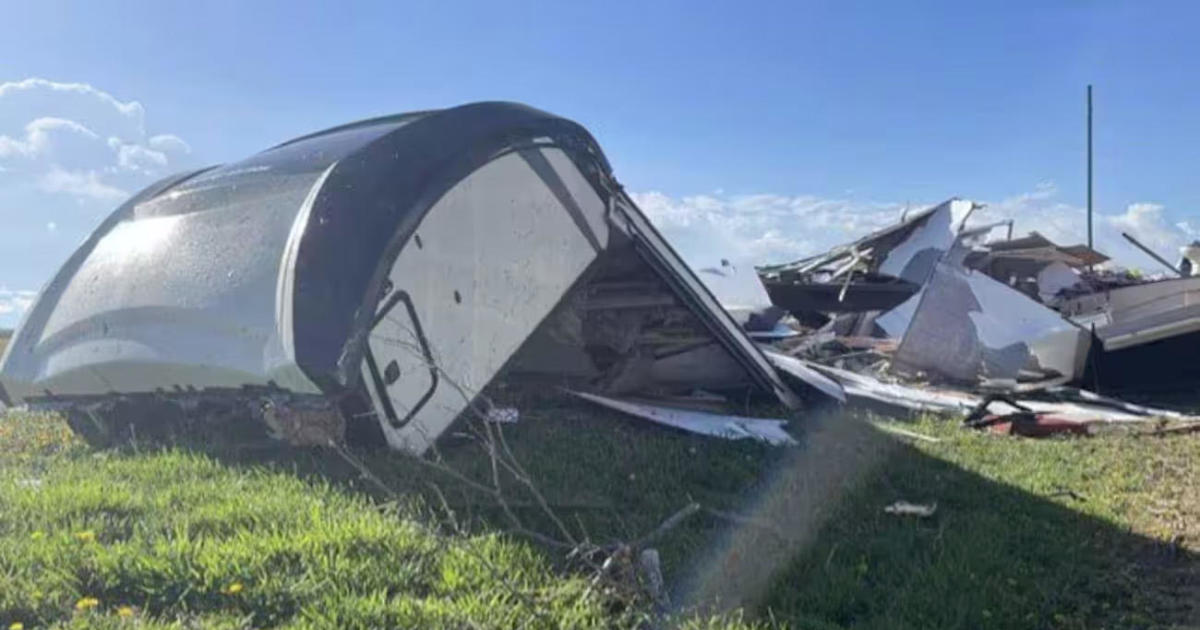
Two people were injured when their RV flipped over during the tornado. Details about the injuries were not immediately available. Buildings and trees also were damaged in the neighboring town of Overbrook.
Eric Ives/WIBW via AP
In central Iowa, a barn was demolished and other buildings were damaged after a tornado touched down in a rural area of Dallas County. The weather service also reported ping pong ball-sized hail in Bloomfield, just north of the Missouri line. There were no immediate reports of injuries.
Iowa State Trooper Paul Gardner was on duty when he spotted a tornado and caught it on camera, sharing the video on social media.
The weather service said the central U.S. was under threat of severe weather through Tuesday. Thunderstorms were expected in parts of Kansas, Missouri, Iowa and northwestern Illinois, potentially with large hail and damaging winds. Some isolated storms were also possible in the mid-South, the service said.
In Missouri, Chicago-bound American Eagle Flight 3661 returned to Kansas City International Airport just before 6 a.m., soon after it took off, due to a possible lightning strike, American Airlines spokesperson Gianna Urgo said in an email. Maintenance workers were inspecting the aircraft to see if it was damaged. Passengers were later put on other flights, Urgo said.
A camper was blown over and the roof was ripped off a building when a strong storm hit the area around Smithville Lake in western Missouri, the Clay County Sheriff’s Department said. Downed trees and power lines were reported in several communities near Kansas City.
CBS Chicago reports the area is facing an evening severe storm threat on Tuesday, with damaging winds, large hail and tornadoes possible. A tornado watch was issued until 10 p.m. for LaSalle and DeKalb counties, west of Chicago, as well as counties farther west in Illinois and in south-central and southwest Wisconsin. Rockford, Dixon, Peoria, and Quincy in Illinois, and Janesville and Madison in Wisconsin, are all affected.
The forecast holds “more active storms tonight and tomorrow … just pushing father eastbound and southbound,” meteorologist Mike Bettes of The Weather Channel told CBS News. “So, active storms in Milwaukee, Chicago, eventually tomorrow Michigan, Ohio.”
For Wednesday, Bettes said, “We’ve got a severe weather threat across Detroit, Fort Wayne, Columbus and Cleveland.”


