


Milton made landfall near Siesta Key, Florida, about five miles west of Sarasota, as a Category 3 hurricane Wednesday night, with maximum sustained winds of 120 mph, the National Hurricane Center said.
The NHC said in an 8:30 p.m. update that “life-threatening storm surge, extreme winds, and flash flooding” were happening over Florida’s central peninsula.
Follow along for live coverage
The storm was downgraded to a category 2 hurricane, with maximum sustained winds of 110 mph, the NHC said in its 10 p.m. update.
The hurricane had spent the last few days exploding into a monster storm as it soaked up its natural fuel, warm water, in the Gulf of Mexico.
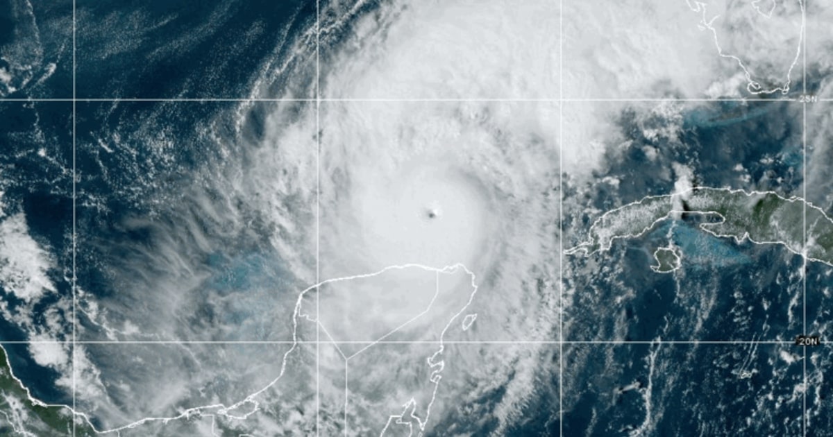
The National Hurricane Center had warned that Milton was likely to strengthen into a major hurricane, defined by minimum sustained winds of 111 mph, and its status was confirmed at 8 a.m. Monday.
On Monday, the NHC said Milton had intensified into a “potentially catastrophic” Category 5 storm. After having shuffled back and forth between a Category 4 and 5 storm on Tuesday, it was downgraded again to Category 4 on Wednesday morning with sustained winds of up to 155 mph.
Storm threats
Federal forecasters said Milton would produce life-threatening storm surges along nearly the entire west coast of Florida while also triggering flash floods and producing destructive winds, initially forecast at 111 mph and greater, near its center, with hurricane-force gusts extending out from there roughly 30 miles.
Milton’s rare origin
Milton’s rapid rise has jolted a Southeastern region still recovering from Hurricane Helene, which made landfall in Florida’s Big Bend region on Sept. 26 and killed more than 230 people in six states.
The latest hurricane is a rare product of the southwest Gulf of Mexico, rather than the Caribbean or the Atlantic.
Milton started as Tropical Depression 14, in the Gulf’s Bay of Campeche, sheltered behind the western coast of Mexico’s Yucatán Peninsula.
Read the full article here


